Sherman Reservoir
Overview
The Felis Concolor Site (25SM20)
OVERVIEW
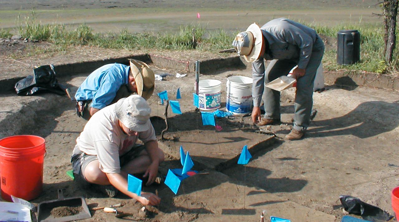
During the summer 2003, the Nebraska Archaeological Survey at the University of Nebraska State Museum completed a 10-week excavation project at a small prehistoric hamlet on Sherman Reservoir near Loup City, Nebraska. This hamlet or the Felis Concolor Site (25SM20) was situated along a low terrace along the eastern edge of Oak Creek. The site consists of at least eight small house pits, as well as a number of associated features.
Project personnel included Dr. Alan Osborn (Project Director), Dan Watson (Field Supervisor), and a small field crew. We were also assisted by five students from the University of Nebraska-Omaha. Our excavations focused on two, small earth lodges and a large storage pit that had been located several years ago by Survey archaeologists including Dr. Steve Holen.
Funding for this project was awarded to the University of Nebraska State Museum by the Bureau of Reclamation prior to the transfer of Sherman Reservoir to the Loup Basin reclamation District and the Sargent and Farwell Irrigation Districts.
Photo gallery
-
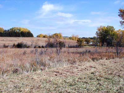
Environmental setting for prehistoric Plains Indian village, near Sherman Reservoir, Sherman County, Nebraska.
-
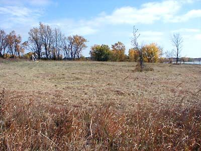
View of village location after it was mowed.
-
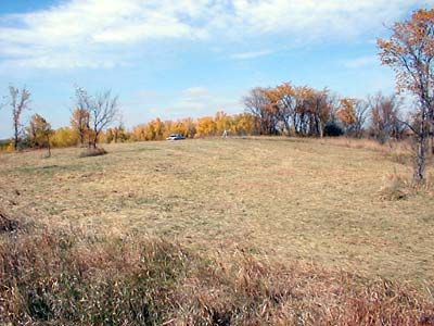
Looking north across the village area on gentle hill slope.
-
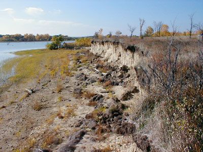
Archaeologists discovered small pottery shards and stone flakes along the eroding cutbank near the village site.
-
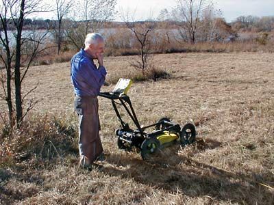
Archaeologist "looks" beneath the ground surface with a portable radar uni prior to excavation during the fall of 2002.
-
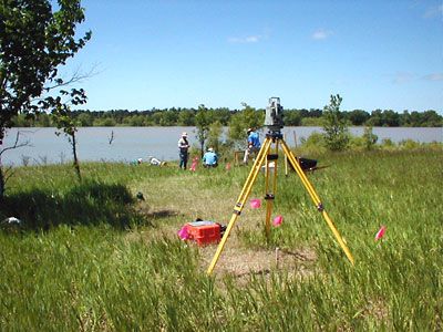
A map was made of the site using an "electronic distance measuring device" or EDM.
-
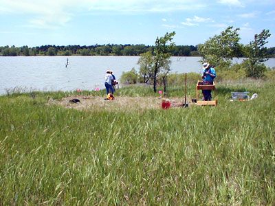
We began to excavate small test squares with shovels and trowels early during the summer of 2003.
-
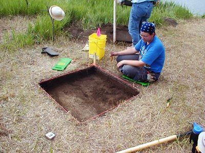
Our crew excavates small test squares to define the first house pit.
-
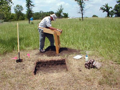
Crew member screens earth to find smaller pottery shards, animal bones, and flakes.
-
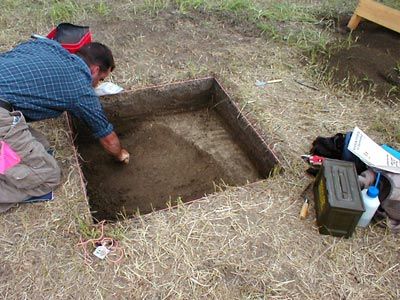
An archaeologist locates the edge of the first house pit that shows up as a dark, loose soil deposit.
-
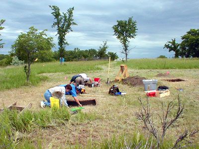
Our field crew begins to excavate a larger area above and around the first house pit area.
-
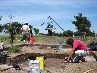
Field crew members continue to define the edges of the first prehistoric house to be excavated last summer.
-
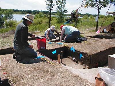
House floor areas are carefully exposed and mapped before pottery shards, animal bones, and small tools are removed.
-
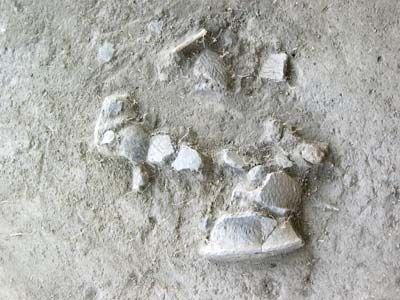
Portions of a prehistoric pottery vessel were found scattered upon the house floor.
-
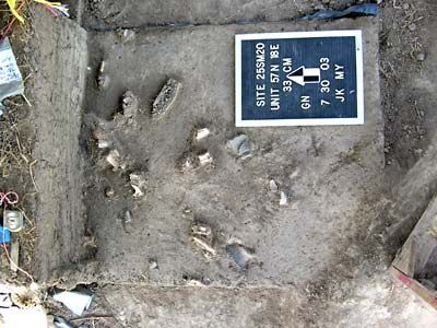
Animal bones and pottery shards found upon house pit floor.
-
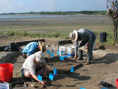
Crew members carefully cleaned and mapped more than 800 prehistoric items- primarily pottery shards and fragments of bison, deer, rodent, and fish bones.
-
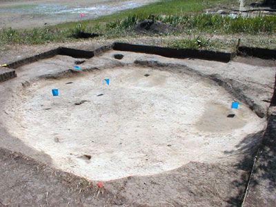
Completed excavation of first prehistoric house- a shallow basin-shaped pit that contained little evidence for a hearth or substantial support posts.
-
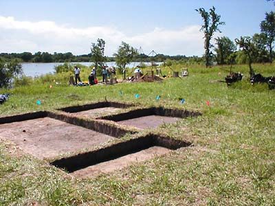
A second prehistoric house was located nearby. A large block excavation was opened using shovels and trowels.
-
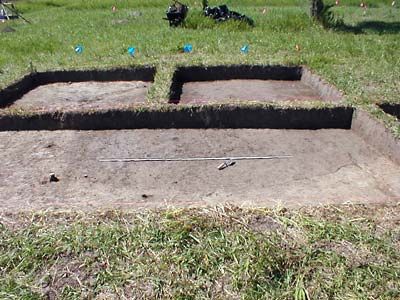
A large, dark soil stain defined the second house pit (center of photograph). Unexcavated soil baulks were left to allow archaeologists to measure depths from original ground surface.
-
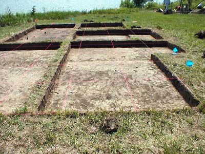
A colored string grid was laid out across the second house excavation prior to installing metal "locator" tags. This grid enables archaeologists to map the locations of all artifacts and architectural features.
-
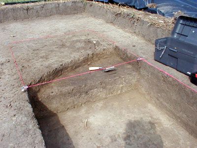
The second house pit was easily defined in a large excavation block.
-
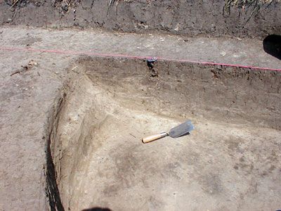
The second house pit was clearly visible below the plow zone.
-
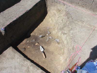
Prehistoric garbage and refuse were discovered on the house floor near the side wall of the pit.
-
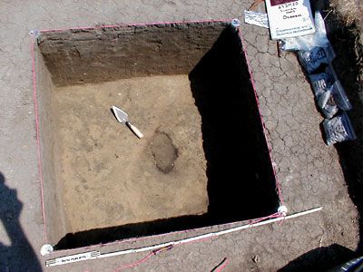
Deeper excavation unit exposed a post mold or post hole (dark, circular area) in the house floor.
-
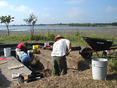
The floor of the second prehistoric house is easy to recognize beneath the plow zone and house fill.
-
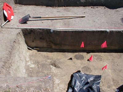
Archaeologists use colored survey flags to mark post locations within the house pit.
-
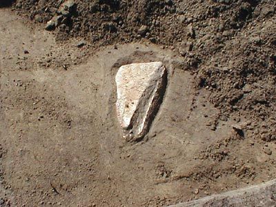
A bison shoulder blade "knife" was found by a university student within the house fill.
-
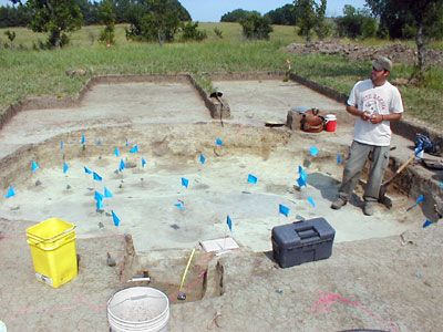
The second house pit was almost completely excavated by the end of our 10-week field season.
-
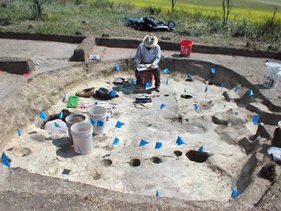
Excavations reveal a "connect-the-dot" puzzle for archaeologists. Can you find the second crew member!
-
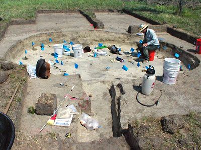
The second house had an entryway trench (bottom-center) that extended outward toward the west.
-
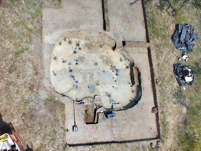
The completed excavation of House 6 was photographed from a "cherry picker crane" provided by Nebraska Public Power District (thanks!).
The Archaeologists of the Nebraska Archeological Survey at the University of Nebraska State Museum
Dr. Alan J. Osborn, Director
Research Assistant Professor, Anthropology
Danial R. Watson, Field assistant
Archaeologist, Bureau of Reclamation
Archaeological Field Crew:
Nancy Carlson
J. Chadwick Gerhold
Jason Kruse
Bill Ranney
Ellen Ritter
Megan Young
UNO Students Volunteers:
Drew Bronson
Holly Coneally
Sarah Lorence
Peg Marshall
Amy Rezac
UNO Faculty Sponsor:
Dr. Beth R. Ritter
Acknowledgements
We would like to acknowledge the following people for their assistance, interest, and friendship during our field work : Marvin Heil and family, Amy (Loup Realty), Mark Eurek, Bernie Kowalski (volunteer), Scott Mroczek, Jim Gembala, Nebraska Game and Parks, Bill Chada (Bureau of Reclamation), UNO student volunteers Drew Bronson, Holly Conneally, Sarah Lorence, Peg Marshall, and Amy Rezac, and UNO Faculty Sponsor Dr. Beth R. Ritter.


